MENU
November 15, 2023
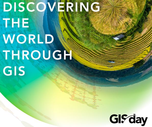
Celebrating Over Two Decades of GIS Day
Celebrating over two Decades of GIS Day
This morning, as I woke up, I was struck with the realization that I’ve been celebrating GIS Day since 2001. That marks over two decades of unwavering dedication to an event that has become a global touchstone since its launch in 1999. Remembering my early days as a zealous GIS Analyst, I was deeply involved in orchestrating GIS Day celebrations, actively serving on the coordinating committee. My journey took a pivotal turn when I changed jobs and became the Senior GIS Manager/Trainer at the then Ministry of Land and Environment. It was under my stewardship with the guidance of the National GIS Coordinator and Permanent Secretary that GIS Day found a consistent venue at the University of the West Indies, Mona campus. Today, I look back with immense pride at being a key player in what has become a 21-year tradition in Jamaica, a tradition that has not only endured but thrived, marking its presence on both map and calendar.
My experience with GIS Day spans multiple countries in the Caribbean and the United States, reinforcing its significance to those of us in the geospatial field. The essence of GIS Day, for me, lies in its role as a platform to illuminate the ‘power of where.’ It transcends sectors, from the smallest of businesses to sprawling enterprises, government entities, and utility services. The common thread is the need for information, particularly spatial information—the ‘where’ factor. Our societal challenges are often rooted in geography, and understanding that geography gives us the leverage to find solutions. GIS Day, thus, isn’t just a celebration; it’s a yearly testament to the critical role geography plays in our decision-making processes.
GIS Explained
GIS is the technology that enables the modeling of real world features and situations in a computing environment in order to map, analyze, and provide intelligence for managing real-world problems. It operates on the foundation of spatial data, which anchors every piece of information to a specific point on the globe. What truly unlocks the vast potential of GIS is its capacity to synthesize diverse datasets from myriad sources, facilitating a spectrum of analyses. By fusing mathematical and statistical techniques with geographic coordinates, GIS empowers us to perform sophisticated spatial analysis and to simulate real-world scenarios with remarkable accuracy.
Consider this staggering fact: more than 70% of the data we encounter has a geographic component. To understand the ubiquity of GIS, try a simple exercise: reflect on your daily life and identify something that lacks a location dimension. Challenging, isn’t it? This realization underscores the pivotal role of GIS—it’s not just an advanced tool for experts; it’s embedded in the fabric of our everyday decision-making and activities, often operating behind the scenes in ways we might not realize. GIS touches different aspects of our lives everyday . From the Navigation systems that guide us on the roads, predicting weather patterns, to urban planning and environmental conservation, GIS touches our lives in so many ways often without our even knowing.
Examples of Day-to-day Application
Cast your gaze upon the vibrant tapestry of the Caribbean, and the profound utility of GIS comes sharply into focus. Take Guyana, for instance, with its sprawling land replete with bountiful natural resources and a delicate coastline below sea level, demanding vigilant protection and oversight. As Guyana strides forward in development, Geospatial Intelligence becomes important for strategic decisions, tackling the multifaceted challenges of economic growth, environmental stewardship, climate change, and disaster preparedness.
Imagine a GIS platform enabling engineers to meticulously monitor and maintain the integrity of sea defenses. With real-time data at their fingertips, they can pinpoint which parts of the barrier demand immediate attention, ensuring the nation’s fortifications stand robust against the encroaching tides.
Beyond safeguarding the land, GIS is integral to harmonizing the complex integration of utility services. Picture the arrangement of roadworks, where data streams converge within GIS—mapping out the who, what, when, and where—creating a dynamic, visual narrative accessible by all stakeholders. This shared digital platform not only streamlines coordination but also mitigates the costly and resource-intensive cycle of redundant work. How often have freshly paved streets been marred by new utility work? GIS can curb such inefficiencies through its comprehensive, up-to-the-minute data repository.
In the commercial space, GIS is a useful tool for uncovering latent markets. Retail chains, for instance, may leverage GIS to decode shopping patterns and select prime locations for new stores, drawing on rich datasets from national census to the chain’s own data.
Even the strategic placement of litter bins within a cityscape falls benefits from the power of a GIS. By cross-referencing pedestrian traffic patterns with local fast-food joints and other high-foot traffic areas, GIS ensures that waste disposal is both effective and environmentally sound.
And let’s not overlook the growing Blue Economy. In a recent discourse, the role of GIS as a navigator toward a thriving digital ocean economy was illuminated. For large ocean nations in the Caribbean, where the sea is both lifeblood and livelihood, the implementation of GIS is a vital step on the path to a sustainable future.
Moving Forward
We live in a rapidly changing world and our future is contingent on our actions and intervention today. As we shape and define the future, it’s important that comprehensive planning takes into account all key aspects that impact our existence. GIS helps us to integrate data from disparate sources to better understand our world so we can meet development challenges. By applying what we know of science and GIS to what we do not know, we can get to what we really need to know. The aim is to enhance the quality of life and manage the environment to ensure a better future. GIS acts as that bridge between the known and the unknown, guiding us toward the insights we need to secure and enhance our quality of life while stewarding our environment for future generations.
Each thread of information woven throughout this article has a location component, underscoring the necessity of spatial tools and analytical thinking. Embracing GIS tools and insights enables us to infuse our decision-making with location intelligence, altering the way we conceptualize and interact with our surroundings. Through GIS, we unlock the ability to discern and appreciate the complex tapestry of environmental interconnections, paving the way for more strategic planning and more sustainable choices in both environmental stewardship and economic development. The ultimate prize of this sophisticated spatial understanding is the safeguarding and nurturing of life itself.
As I reflect on over two decades as a professional in the geospatial industry, I’m reminded of the profound influence geospatial technology and science has on our daily lives and the broader strokes of global development. From the bustling streets of urban centers to the quiet, undulating waves of the Caribbean, GIS has proven to be an indispensable tool in our collective journey towards a sustainable future.
As we continue to celebrate GIS Day each year, we are affirming our commitment to a worldview that recognizes the intricate connections between location, data, and decision-making. It is a celebration of the human spirit’s endless quest for knowledge and our unyielding desire to chart a better, more informed course for future generations.
Looking ahead, we stand on the brink of new GIS frontiers, ripe with potential and promise. The mantle rests on the shoulders of the GIS professionals to harness geospatial insights with wisdom and foresight, ever mindful that the maps we create today are blueprints for tomorrow. Here’s to another two decades of innovation, discovery, and geographic enlightenment. Happy GIS Day 2023 —may our understanding of the world continue to expand. Today, November 15, 2023, we take a moment to extend our gratitude to the many GIS professionals globally that are helping us to discover our world.
About Valrie
Valrie Grant is an internationally respected geospatial scientist with a passion for science and entrepreneurship. Since 2008, she has built GeoTechVision into a major player in the growing Caribbean Geomatics and Geospatial services industry, earning along the way a litany of special recognitions and awards. Her latest initiative, EduTechAid seeks to respond to the inequality of access to digital tools in education and empower youths. She has served on several national, regional and international Boards and Committees such as the World Geospatial Industry Council (WGIC) and the United Nations Global Geospatial Information Management (UN-GGIM): Americas Private Sector Network for which she is the current Chair. She is also the vice-chair of UN-GGIM PSN at the global level. Valrie is a 2020 WE Empower UN Sustainability Development Goals Challenge Awardee. She has authored the books “Every Day is Day One : Maintaining the Startup Culture and Mindset” and “Hills and Valleys: Poems of Resilience.” This award-winning entrepreneur believes in simply living a great story and endeavors to live her best life every day.


